

In 1861, U.S. Coast Survey supervisor Alexander Dallas Bache published Notes on the Coast of the United States. Thereafter, reports were published each year from 1861 to 1865. Initially used by the Union army, the maps, charts, and geographic information were the target of Southern sympathizers as well who sought to give their own army an edge in the military campaigns that raged during this period."In 1807, President Thomas Jefferson established the Survey of the Coast to produce the nautical charts necessary for maritime safety, defense, and the establishment of national boundaries. Within years, the United States Coast Survey was the government’s leading scientific agency, charting coastlines and determining land elevations for the nation. In 1861, the agency adjusted quickly to meet the needs of a country at war…" - NOAA
Image via Wikipedia
Alexander Dallas Bache (1806 - 1867), American scientist,
U.S. Coast Guard official.

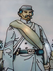 Image by mharrsch via Flickr Image by mharrsch via Flickr |
| Stained Glass of a Confederate Soldier of the American Civil War at Bardstown Kentucky |
Like the maps of the Lewis and Clark expedition, these priceless documents are another great legacy left to us by our third president, Thomas Jefferson. If you want to explore some of the Lewis and Clark maps, check out Lewis and Clark: The Maps of Exploration 1507 - 1814, and excellent website compiled by the University of Virgina Library.


American Maps and Map Makers of the Revolution (Revolutionary War Bicentennial)

No comments:
Post a Comment